Related Posts


10. Ganges
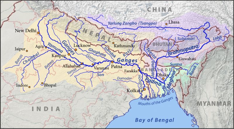
fot. Pfly / wikipedia.org (CC BY-SA 4.0)
- length: 2,700 km
- catchment area: 1,016,124 km²
- average flow: 16,648 m³/s
- countries: India, Bangladesh
- source: Himalayas
- estuary: Bay of Bengal
9. Amur
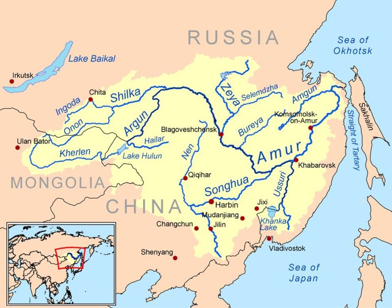
fot. Kmusser / wikipedia.org (CC BY-SA 3.0)
- length: 2,824 km
- catchment area: 1,856,000 km²
- average flow: 10,800 m³/s
- countries: Russia, China
- source: the province of Khentia
- estuary: Sea of Okhotsk
8. Indus River

fot. Nomi887 / wikipedia.org (CC BY-SA 4.0)
- length: 3,180 km
- catchment area: 960,000 km²
- average flow: 3,850 m³/s
- countries: China, India, Pakistan
- source: Kajlas mountain
- estuary: Arabian Sea
7. Yenisey

fot. LxAndrew / wikipedia.org (CC BY-SA 4.0)
- length: 3,487 km
- catchment area: 2,580,000 km²
- average flow: 19,800 m³/s
- country: Russia
- source: Kyzyl
- estuary: Kara Sea
6. Ob

fot. Aladux / wikipedia.org (CC BY-SA 3.0)
- length: 3,650 km
- catchment area: 2,972,497 km²
- average flow: 12,500 m³/s
- country: Russia
- source: Altai Krai
- estuary: Kara Sea
5. Irtysh
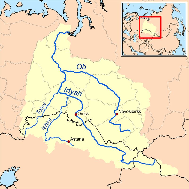
fot. Karl Musser / wikipedia.org (CC BY-SA 2.5)
- length: 4,248 km
- catchment area: 1,643,000 km²
- average flow: 2,260 m³/s
- countries: China, Kazakhstan, Russia
- source: Mongolian Altai
- estuary: Ob
4. Lena
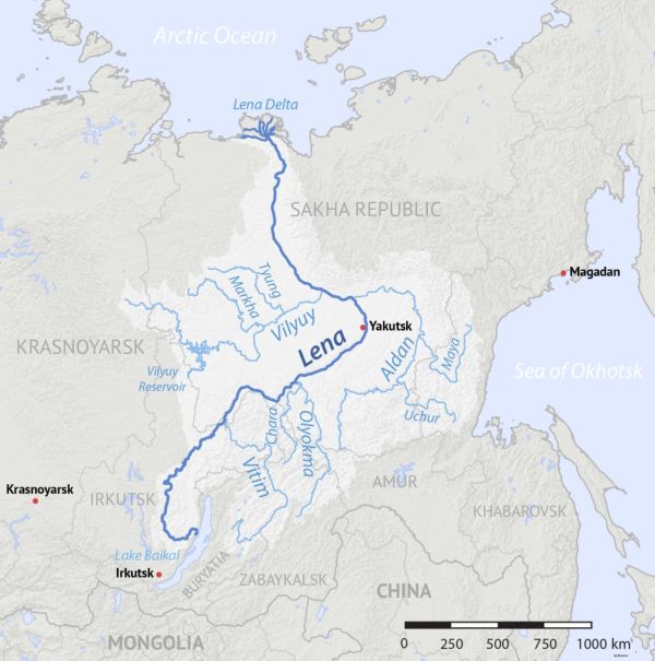
fot. Shannon1 / wikipedia.org (CC BY-SA 4.0)
- length: 4,400 km
- catchment area: 2,490,000 km²
- average flow: 16,400 m³/s
- country: Russia
- source: Baikal Mountains
- estuary: Arctic Ocean
3. Mekong
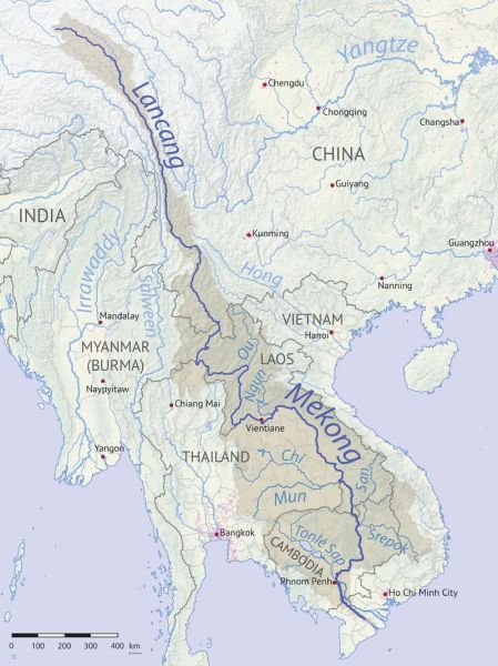
fot. Shannon1 / wikipedia.org (CC BY-SA 4.0)
- length: 4,880 km
- catchment area: 795,000 km²
- average flow: 16,000 m³/s
- countries: China, Myanmar, Thailand, Laos, Cambodia, Vietnam
- source: Tibetan plateau
- estuary: South China Sea
2. Yellow River
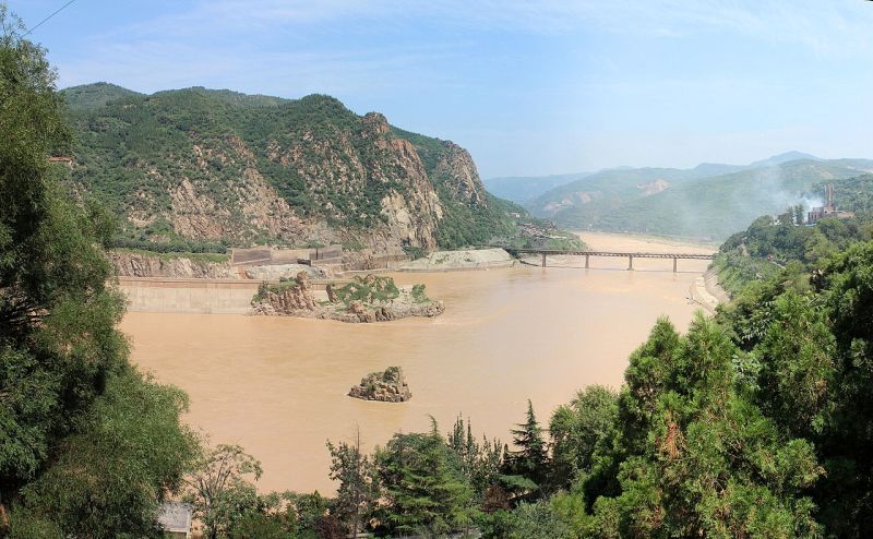
fot. fading / wikipedia.org (CC BY-SA 3.0)
- length: 5,464 km
- catchment area: 752,400 km²
- average flow: 1,210 m³/s
- country: China
- source: Bayan Har Shan
- estuary: Pohaj Bay, Yellow Sea
1. Yangtze

fot. Keenan Pepper / wikipedia.org (CC BY-SA 4.0)
- length: 6,300 km
- catchment area: 1,807,199 km²
- average flow: 31,060 m³/s
- country: China
- source: Tibetan plateau, Tangla
- estuary: East China Sea

